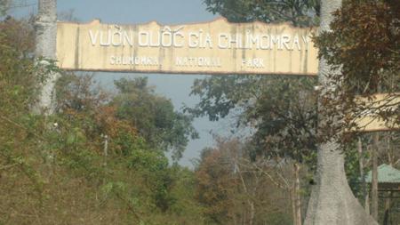
Chu Mom Ray National Park is situated in western Kon Tum province, in the Central Highlands, close to the point where Vietnam, Laos and Cambodia meet. The two main forest types at Chu Mom Ray National Park are lowland evergreen forest, which is distributed below 1,000 m, and lower montane evergreen forest, which is distributed above this elevation. In addition, there are smaller areas of lowland semi-evergreen forest, distributed at elevations below 700 m. The remainder of the national park supports a range of secondary vegetation types, including large areas of bamboo and a central area of grassland that developed following the wartime use of defoliants along the Ho Chi Minh Trail; this latter area has now become important for wild cattle.
According to the World Bank Forest Protection and Rural Development (FPRD) Project, the most important conservation issues at Chu Mom Ray National Park are:
(i) The boundary of the national park is not clearly demarcated, although, except for 21 km on the eastern side, which has the most pressure from villages, there are plans to completed boundary demarcation by 2004;
(ii) There is an encroachment from villages bordering the national park;
(iii) Hunting is taking place within the national park;
(iv) non-timber forest products and timber are extracted from the national park;
(v) The main road that cuts through the middle of the national park is being upgraded for use by rubber plantations in Mo Ray commune;
(vi) The area was heavily bombed and sprayed with defoliants during the Second Indochina War; and
(vii) There is a significant threat of forest fire along the eastern edge of the national park, with the development of commercial pine and Acacia plantations.
Source: Vnppa.org.vn

