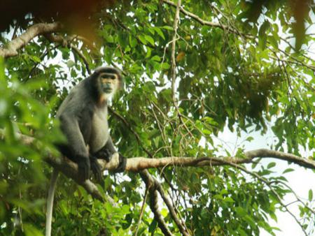
Bu Gia Map National Park is situated in the lowlands of southern Vietnam, which attains a maximum elevation of 700 m. Principal watercourses encompassed by the national park include the Dak Huyt stream, that flows along the border between Vietnam and Cambodia, and also the Dak Sa, Dak Sam, Dak K’me, Dak Ka and several other streams.
The major threats to biodiversity at Bu Gia Map are illegal timber extraction, hunting, over-exploitation of non-timber forest products, cultivation within the national park, and forest fire. During the conservation needs assessment for the national park, illegal timber extraction and hunting was assessed as being the most severe threats. Timber, particularly of high value species, such as Dalbergia sp. and Pterocarpus sp., is extracted illegally by local people working on behalf of traders; because of the number of people involved in this activity, the total volume of timber extracted is significant. Hunting and trapping are carried out be ethnic minority inhabitants of the buffer zone. Some hunting is for subsistence use but much is to supply the illegal trade in wildlife and wildlife products. As a result of increasing market demand, hunting pressure on wildlife populations in the national park is increasing, threatening the continued survival of many animal species.
Source: vnppa.org.vn

